Bowditch Rule for Traverse Adjustment Explained
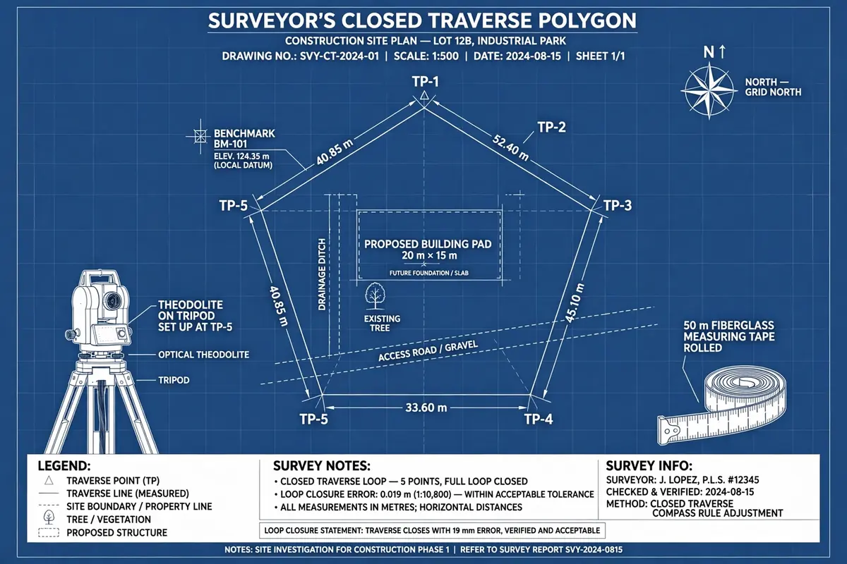
Learn the Bowditch rule for traverse adjustment: how to distribute closing errors in a closed traverse, with a fully worked five-station numerical example.
Walk a closed traverse around a site, add up all your latitudes and departures, and they should come back to exactly zero. In real life, they never do. Small errors creep into every angle and every distance you measure, and by the time you return to your starting point, you are a few centimetres off. That gap is your closing error, and you cannot just ignore it — if you plot the traverse as measured, the last leg will not meet the first point, and every coordinate you compute after that will be wrong.
The Bowditch rule, also called the compass rule, is the standard way of spreading that closing error across the whole traverse so the polygon closes cleanly. It is simple, it is fair, and it has been the working surveyor's method for well over a century. This article explains what the rule is, why it works, and walks through a complete five-station example, numbers and all.
What a traverse closing error actually is
A traverse is a series of connected survey lines. For each line you measure its length and its bearing, and from those two numbers you compute two components:
- Latitude — the north-south component: length × cos(bearing). Positive to the north, negative to the south.
- Departure — the east-west component: length × sin(bearing). Positive to the east, negative to the west.
In a closed traverse you start at a known point, run around the site, and finish back at the same point. So the latitudes must sum to zero and the departures must sum to zero. In practice you get two small leftovers instead:
- Error in latitude, eL — the sum of all the latitudes.
- Error in departure, eD — the sum of all the departures.
Combine them and you get the linear misclosure: √(eL² + eD²). That is the straight-line distance by which your traverse fails to close — the gap between where you started and where your measurements say you ended up. Divide it by the total length of the traverse (the perimeter) and you get the relative accuracy, usually written as 1 in so-many. A misclosure of 0.30 m over a 470 m traverse, for example, is a relative accuracy of about 1 in 1,570.
Before you adjust anything, check that the misclosure is within the tolerance your job demands. For ordinary construction setting out, 1 in 1,000 to 1 in 3,000 is commonly accepted; control surveys demand much tighter. If the misclosure is far outside tolerance, do not adjust — go back and re-measure, because a blunder (a misread tape, a transposed digit, a wrong bearing) is more likely than ordinary measurement error.
The Bowditch rule in one paragraph
The Bowditch rule assumes that the errors in your angles and distances are random and roughly proportional to the length of each line — a long line accumulates more error than a short one, simply because there is more measuring to get wrong. So it distributes the total error in proportion to line length. The correction applied to each line is:
Correction to latitude of a line = −eL × (length of that line ÷ total traverse length)
Correction to departure of a line = −eD × (length of that line ÷ total traverse length)
The minus sign matters: the correction always works against the error. If the latitudes sum to −0.18 m (you are 0.18 m short in the north direction), the corrections add a total of +0.18 m back, shared out line by line. Apply the corrections, and the adjusted latitudes and departures sum to exactly zero. The traverse closes.
One condition before you start: adjust the angles first. The Bowditch rule distributes the linear misclosure, but it assumes the angular misclosure has already been dealt with — the interior angles of an n-sided polygon must sum to (n − 2) × 180°, and any small angular error should be spread evenly across the angles before you compute latitudes and departures. Bowditch on top of unadjusted angles just smears an angular blunder across the whole job.
Worked example: a five-station closed traverse
Take a closed traverse with stations A, B, C, D and E. The field measurements have already been reduced to latitudes and departures for each leg:
- AB: length 120.00 m, latitude +84.85 m, departure +84.85 m
- BC: length 95.50 m, latitude −55.45 m, departure +77.75 m
- CD: length 110.25 m, latitude −99.92 m, departure −46.59 m
- DE: length 88.75 m, latitude +24.11 m, departure −85.41 m
- EA: length 55.31 m, latitude +46.23 m, departure −30.36 m
Step 1: Find the closing errors
Add up the latitudes: 84.85 − 55.45 − 99.92 + 24.11 + 46.23 = −0.18 m. So eL = −0.18 m. Add up the departures: 84.85 + 77.75 − 46.59 − 85.41 − 30.36 = +0.24 m. So eD = +0.24 m.
Linear misclosure = √(0.18² + 0.24²) = √(0.0324 + 0.0576) = √0.09 = 0.30 m. The total traverse length is 120.00 + 95.50 + 110.25 + 88.75 + 55.31 = 469.81 m. Relative accuracy = 0.30 ÷ 469.81 ≈ 1 in 1,570 — acceptable for ordinary site work, so we proceed with the adjustment.
Step 2: Compute the Bowditch corrections
The correction factor for latitude is −eL ÷ perimeter = +0.18 ÷ 469.81 = +0.000383 per metre of line. For departure it is −eD ÷ perimeter = −0.24 ÷ 469.81 = −0.000511 per metre. Multiply each by the line length:
- AB (120.00 m): latitude correction +0.046 m, departure correction −0.061 m
- BC (95.50 m): latitude correction +0.037 m, departure correction −0.049 m
- CD (110.25 m): latitude correction +0.042 m, departure correction −0.056 m
- DE (88.75 m): latitude correction +0.034 m, departure correction −0.045 m
- EA (55.31 m): latitude correction +0.021 m, departure correction −0.028 m
Notice how the longest line, AB, takes the biggest correction and the shortest line, EA, the smallest. That is the whole idea: longer lines carry more of the error because they contributed more of it.
Step 3: Apply the corrections and check the closure
Add each correction to its observed value:
- AB: latitude 84.85 + 0.046 = 84.896 m, departure 84.85 − 0.061 = 84.789 m
- BC: latitude −55.45 + 0.037 = −55.413 m, departure 77.75 − 0.049 = 77.701 m
- CD: latitude −99.92 + 0.042 = −99.878 m, departure −46.59 − 0.056 = −46.646 m
- DE: latitude 24.11 + 0.034 = 24.144 m, departure −85.41 − 0.045 = −85.455 m
- EA: latitude 46.23 + 0.021 = 46.251 m, departure −30.36 − 0.028 = −30.388 m
Now sum the adjusted latitudes: 84.896 − 55.413 − 99.878 + 24.144 + 46.251 = 0.000 m. Sum the adjusted departures: 84.789 + 77.701 − 46.646 − 85.455 − 30.388 = 0.001 m — a single millimetre left over from rounding the corrections to three decimals, which is nothing to worry about. The traverse now closes.
Step 4: Compute the adjusted coordinates
With the adjusted latitudes and departures, coordinates follow by simple accumulation. Give station A the local coordinates (1000.000 m E, 1000.000 m N). Add each leg's adjusted departure to the easting and its adjusted latitude to the northing:
- B = A + (84.789, 84.896) = (1084.789 E, 1084.896 N)
- C = B + (77.701, −55.413) = (1162.490 E, 1029.483 N)
- D = C + (−46.646, −99.878) = (1115.844 E, 929.605 N)
- E = D + (−85.455, 24.144) = (1030.389 E, 953.749 N)
- Back to A = E + (−30.388, 46.251) = (1000.001 E, 1000.000 N)
We return to A within a millimetre — the rounding residue, not a real error. These adjusted coordinates are the ones you plot, stake out from, and hand to the design team.
Bowditch rule vs transit rule: when to use which
The main alternative is the transit rule, which distributes the latitude error in proportion to the latitudes themselves and the departure error in proportion to the departures. The transit rule suits work where angular errors dominate — for example, a traverse run with a theodolite of modest accuracy but very carefully chained distances. The Bowditch rule suits the more common case, where distance and angle measurements are of comparable quality and errors are essentially random. On most construction sites, that is the honest assumption, which is why the compass rule remains the default in textbooks and in field practice. Where a project demands rigorous adjustment — a control network for a large structure, for example — neither rule is enough, and a least-squares adjustment is the proper tool. But for a site traverse, Bowditch is the right balance of rigour and practicality.
Common mistakes to avoid
- Adjusting before checking tolerance. If the misclosure is far outside what the job allows, an adjustment hides a blunder. Re-measure first.
- Forgetting the angular adjustment. Bowditch fixes linear misclosure only. Adjust the angles first so the interior angles sum to (n − 2) × 180°.
- Getting the sign wrong. Corrections oppose the error. If the latitude sum is negative, latitude corrections are positive. Always check that the adjusted sums come back to zero.
- Rounding too early. Carry corrections to at least three decimals through the calculation and round only at the end, or the adjusted traverse will not quite close.
- Applying Bowditch to an open traverse. The rule needs a closed loop (or a traverse tied between two known points) so that a definite closing error exists. On an open, unclosed traverse there is nothing to distribute.
Frequently asked questions
Why is it called the compass rule?
Because it was developed for traverses run with a compass and chain, where distance errors were the dominant source of misclosure and were naturally proportional to line length. The name stuck even though modern traverses use total stations.
Does the Bowditch rule change the measured distances?
Strictly, it changes the latitudes and departures, which slightly changes the implied lengths and bearings of each leg. The changes are tiny — a few centimetres over a hundred metres — and that is the point: the adjustment is spread so thinly that no single leg is distorted.
What if one leg is clearly the source of the error?
Then do not use Bowditch blindly. If, say, one distance was taped on a steep slope without correction, that leg carries a systematic error, not a random one. Find it, correct it, and re-run the closure check before adjusting anything.
The Bowditch rule will not rescue bad fieldwork, but for a traverse that has been run carefully, it turns a small, unavoidable closing error into a clean, closed set of coordinates you can build from. Run the check, spread the error by length, verify the closure, and only then plot the traverse.
Calculations and engineering guides are for planning and educational reference. Verify final designs against applicable codes with a licensed Professional Engineer.